Statewide walkability data is available for download
Sponsoring Agency: Florida Department of Health, Division of Community Health Promotion
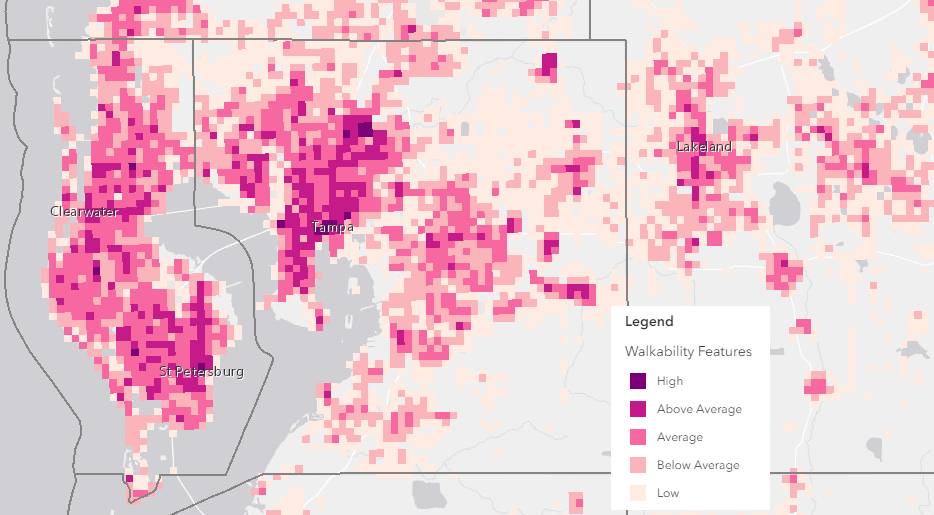
This report was commissioned to examine, analyze, and evaluate walkability measures in current academic literature, assess the data available, develop a suitable walkability metric for Florida, and design online maps to visualize Florida’s walkability using this devised formula. A broader wish for the Department of Health is that the results of this study are useful to local planners for designing more walkable communities with the long-term goal of increasing physical activity.
View Walkability Data in the online Map
Download the Full Report (PDF)
Metadata URL
Data Download (8 MB) Pre-styled for ArcMap (.mxd) and QGIS (.qgs) shapefile formats.

Florida Walkability Measures by FREAC is licensed under a Creative Commons Attribution 4.0 International License.
To cite this data:
FREAC (2018). Florida walkability measures [GIS Shapefile]. Tallahassee: Florida Resources and Environmental Analysis Center, Florida State University. Funded by the Florida Department of Health through a grant from the Center for Disease Control.
