USNG GIS Data Model. How the data model works
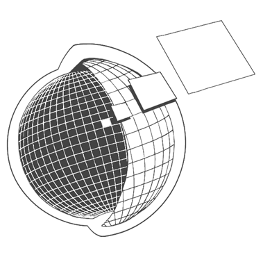
Every area of the earth can be represented by multiple grids at 1m, 10m, 100m, 1km, 10km, and 100km scales. Unlike a latitude and longitude coordinate, a USNG coordinate recognizes an area, not just a point.
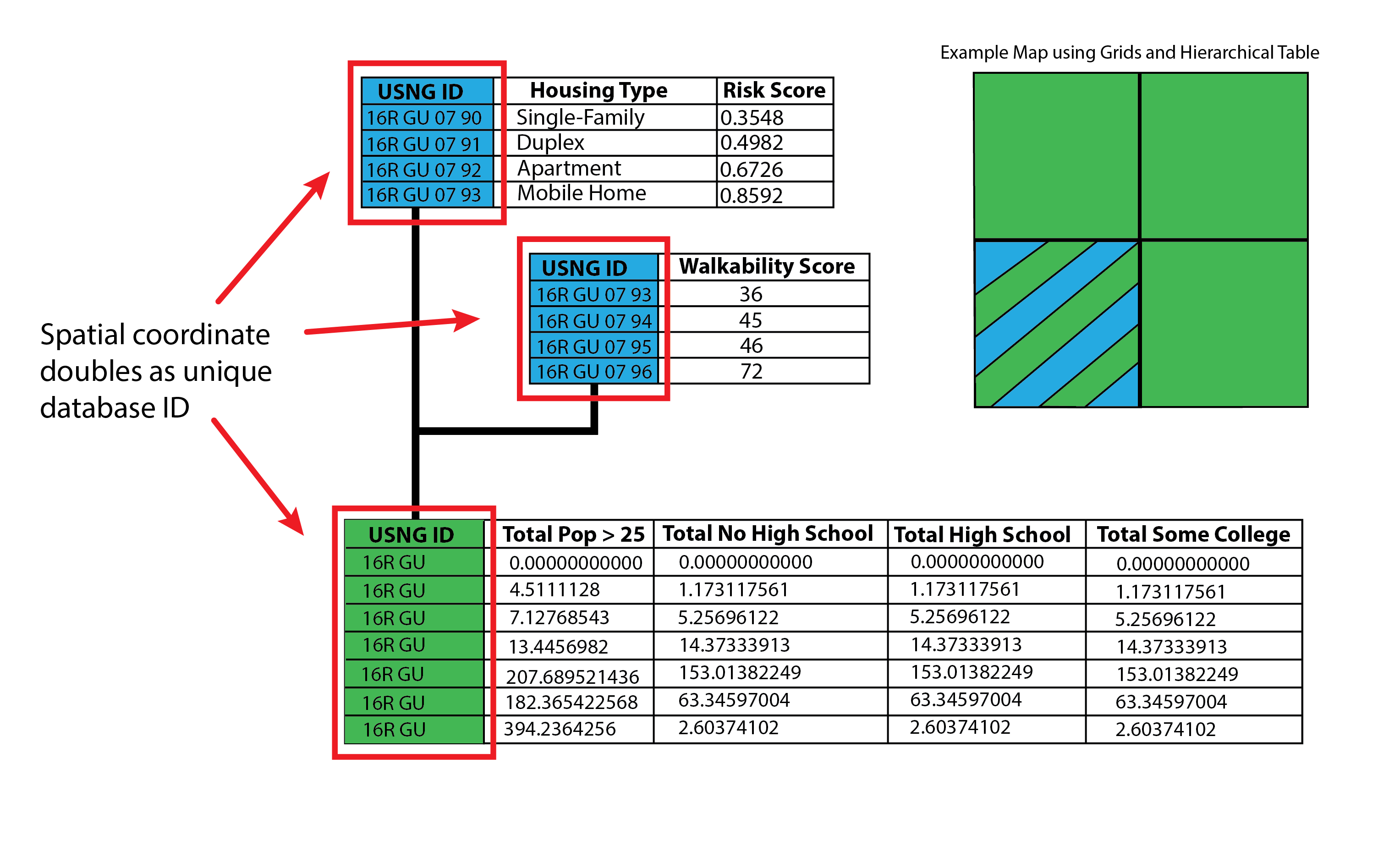
Each grid cell has its own unique identifier. This identifier conveys location and scale. This identifier can double as a unique identifier of a GIS database.
How can this be used in GIS? Below are a few examples.
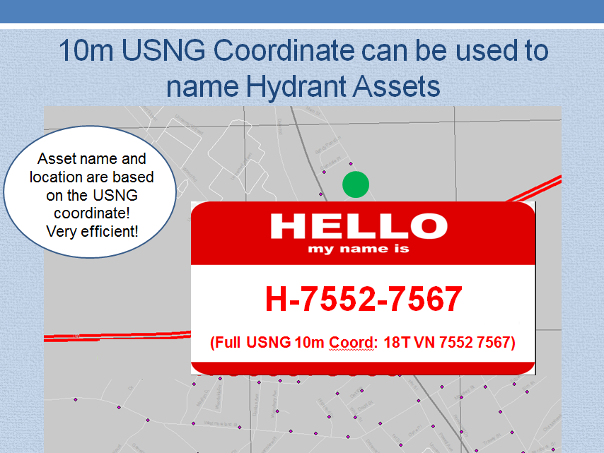
The USNG can be used as a naming convention for point features.
-- Courtesy Elisabetta DeGironimo, Mohawk Valley Water Authority, New York
The USNG can also be used for relational and hierarchical database structures using the USNG identifier.
The USNG GIS Data Model is scalable, flexible, with built-in locational
intelligence. The result is a robust, flexible, standardized spatial data model that supports visualization, analysis, archival, and data transfer at multiple scales.